Cornell instruments gather radio ‘disruption’ data in ionosphere
By Blaine Friedlander
Two NASA sounding rockets soared into the late-night heavens above the small, lightly populated Kwajalein Atoll in the Marshall Islands on June 19. They deployed two tracers – one that forms artificial clouds – perfect for studying communication disruptions in the upper atmosphere.
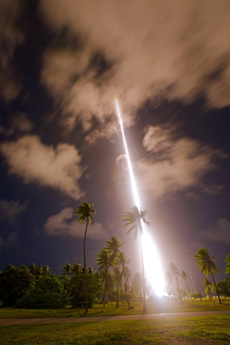
A sounding rocket launches June 19 on Kwajalein Atoll in the Marshall Islands.
The rockets were sent to the edges of the atmosphere to gather information for the “Waves and Instabilities from a Neutral Dynamo” mission, better known as Too-WINDY.
“The data won’t be intelligible until it has undergone considerable processing, which will take us weeks or months,” said the project’s lead investigator David Hysell, professor and chair of Cornell’s Department of Earth and Atmospheric Sciences.
The scientists collected information on electron densities, as well as electric-field, magnetic-field and neutral-wind profiles in the upper atmosphere and ionosphere – the layer bombarded by solar and cosmic radiation – at altitudes between 80 and 350 kilometers. Some of the ionosphere’s layers close to Earth’s equator – considered a “low magnetic latitude” – degrade radio and radar signals more than the rest of the ionosphere.
Predicting these upper atmospheric and ionospheric disturbances ahead of time could help improve the reliability of space- and ground-based communication systems.
“The goal of all this is to measure, understand and ultimately predict a kind of space weather that is common at low magnetic latitudes,” Hysell said.
The rockets’ data-collection and instrumentation were developed and built at Cornell over the last two years by Steve Powell, a research engineer in the School of Electrical and Computer Engineering, with help from Siddhant Rao ’18.
The first rocket launched at 11:28 p.m. local time (7:28 a.m. EDT) and flew to an altitude of 232 miles. The rocket released trimethylaluminum (TMA) and lithium, according to NASA’s Wallops Flight Facility, Wallops Island, Virginia, which was in charge of the Marshall Islands launch.
The mission’s second rocket launched five minutes later and flew to a 256-mile altitude.
While the lithium vapor is not visible to the naked eye, it can be viewed with the special cameras. The TMA formed white artificial clouds that glow in the night sky; a NASA Langley Research Center aircraft photographed the clouds’ movement to measure the winds and their moving energetic particles in the upper atmosphere. Both tracers are harmless to humans at that altitude, according to the space agency.
Researchers from Clemson University and Boston College also supported this mission.
Media Contact
Get Cornell news delivered right to your inbox.
Subscribe