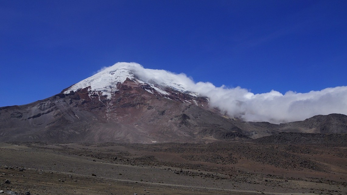
Mount Chimborazo in Ecuador is one of many volcanoes around the world covered by a glacier. New Cornell research has shown how glaciers can warn of future volcanic unrest.
News directly from Cornell's colleges and centers
Glaciers could become ‘icy thermometers’ used to monitor volcanoes
By Syl Kacapyr
Glaciers could become a powerful tool for monitoring some volcanoes, according to new research that shows for the first time how the altitude of glaciers located on volcanoes could signal future unrest including the threat of an eruption.
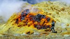
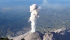
Monitoring volcanoes is dangerous, expensive and logistically challenging. Around 250 volcanoes worldwide are covered by glaciers, which present an extra challenge when it comes to monitoring. But scientists have now shown how glaciers can provide important clues on the behavior of volcanoes, by sensing their temperature.
The findings were published Aug. 31 in the journal Geology.
A team that included researchers from the Department of Earth and Atmospheric Sciences at Cornell Engineering and the University of Aberdeen’s School of Geosciences studied 600 glaciers in South America and showed that glaciers located on volcanoes are confined to higher altitudes, while those around the volcanoes reach lower altitudes. This happens because the increased temperature experienced on or near a volcano causes more ice to melt, limiting glaciers to higher altitudes.
Prior to a period of unrest the temperature of a volcano often increases and by establishing a link between volcanoes and glaciers sitting on them, scientists can now tell which volcanoes have a higher temperature and might be more likely to erupt. It could even be used when other monitoring techniques are not possible.
“It is often difficult to monitor changes to glacier covered volcanoes using satellites. The ice can prohibit us from seeing changes that are occurring and might presage eruptions,” said Matthew Pritchard, professor of earth and atmospheric science and director of Cornell’s Institute for the Study of the Continents. “But closer monitoring of changes to the glaciers themselves could help us to better monitor these volcanoes and see if the volcanoes are heating up.”
Leading the project was Stephen Howcutt along with professors Matteo Spagnolo and Brice Rea from the University of Aberdeen, who were inspired after learning of research published by Pritchard in 2019 that merged 17 years of satellite data on volcanoes with ground-based detail. The Aberdeen researchers saw a new application for the data - focusing on volcanoes covered with glaciers and comparing Cornell’s temperature measurements with observations of the glaciers themselves.
“Our research is the first time a quantitative relationship has been established between glacier elevation and volcanic temperature over a large area, which creates exciting possibilities for monitoring,” Spagnolo said.
Study co-author and Cornell doctoral student Andrea Gomez-Patron added: “As volcanoes provide lots of fertile soil, we often see many towns near them. Understanding at what elevated rate glaciers are melting on volcanoes and where that glacial runoff might flow and pool could help us with hazard assessment for the local populations of these nearby towns.”
The research was funded by the Leverhulme Trust and Natural Environment Research Council.
Syl Kacapyr is associate director of marketing and communications for Cornell Engineering. This article was adapted with permission from a version published by the University of Aberdeen.
Media Contact
Get Cornell news delivered right to your inbox.
Subscribe