News directly from Cornell's colleges and centers
Cornell researchers build ‘digital twin’ to model Manhattan air quality
By Diane Tessaglia-Hymes
Cornell engineers have developed a “digital twin” framework that creates a real-time virtual representation of urban carbon dioxide conditions, creating a tool that could help city planners monitor emissions, identify hotspots and evaluate potential interventions before implementing them in the real world.
Published July 25 in the journal Environmental Modelling & Software, the project used Manhattan as its first test case and was led by H. Oliver Gao, director of the Systems Engineering Program and the Center for Transportation, Environment, and Community Health in the Cornell Duffield College of Engineering.
In urban areas, transportation, energy, water, waste and public health systems are all interconnected, and the data that is used to manage these systems often come from different sources, formats and timelines. Small changes in one part can ripple through others, making it difficult to create a complete and accurate picture of how a city is functioning. Digital twins offer a potential solution as cities grow and as managing urban health and sustainability become even more complex.
A digital twin is a real-time digital replica of a physical entity or system that continuously incorporates real-world data into its computational models. Using a large-scale virtual representation of carbon dioxide levels in Manhattan, the researchers developed a prototype that used these measurements as a demonstration variable to test the framework’s ability to integrate data, estimate conditions across space and time, and visualize environmental information at large scales.
The group’s “Sustainable Urban Digital Twin” used four layers of modular digital twin architecture that worked together. The physical layer collected data from several large databases which was then organized and modeled by the digital layer. The brain layer analyzed this data using Bayesian modeling and machine learning to predict outcomes. The final component, the service layer, suggested actions and provided practical tools, such as visualization, for decision makers. This prototype provides a way for researchers, city planners and policymakers to monitor emission levels and identify hotspots in Manhattan.
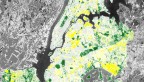
Using the digital twin, the researchers were able to successfully import and integrate data from different sources into one platform, monitor carbon dioxide levels, quantify uncertainty in the data, and then generate maps and visualizations showing how conditions varied across the city.
“We chose Manhattan as our pilot site because it is a dense and complex urban environment that would be challenging test for our digital twin,” said Yishuo Jiang, an Ezra Postdoctoral Fellow in the Systems Engineering Program and co-lead author of the study. “We had access to data from across the city that recorded carbon dioxide concentration, air temperature and humidity every five minutes, so we chose carbon dioxide as a variable to test our prototype. This allowed us to examine spatial patterns, compare the data from various locations, and identify potential emission hotspots across Manhattan.”
The researchers caution that the current platform should be viewed as a research prototype. While it successfully demonstrated CO2-focused monitoring and visualization, additional work is needed before the system can support comprehensive management of pollutants such as particulate matter, nitrogen oxides or ground-level ozone.
The researchers envision that the platform, once developed fully, could help city officials and urban planners by allowing exploratory analyses of air quality and exposure assessments of air quality-related health impacts; and also assisting with strategic decision making, such as evaluating mitigation strategies and analyzing air quality trends through time and space. Simplified dashboards for community access could provide residents with a way to better understand neighborhood environmental conditions.
The researchers propose expanding the platform by adding measurements and models for additional pollutants, adding AI-assisted decision support and working with partners to test the model in other cities.
“We see this work as an early step toward a new generation of urban intelligence systems,” Gao said. “Our long-term vision is to build such systems across cities and urban domains, turning data and models into actionable intelligence for healthier, more sustainable and more resilient communities.”
Co-authors include Vivien Chen ’28, Department of Operations Research and Information Engineering; Zhaoyao Bao, postdoctoral associate, School of Civil and Environmental Engineering; Xinlai Liu, Ezra Postdoctoral Fellow, Systems Engineering Program; and Benedict Jun Ma, assistant professor in the Hong Kong University of Science and Technology (Guangzhou), China.
Media Contact
Get Cornell news delivered right to your inbox.
Subscribe