Frozen in time, cracks reveal earthquake history
By Anne Ju

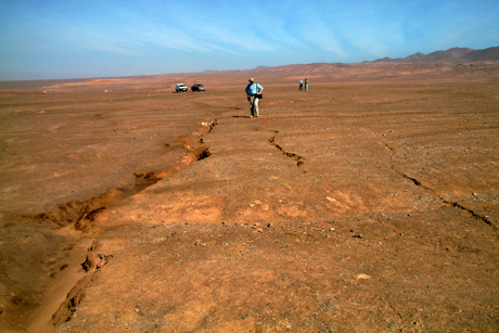
Northern Chile’s Atacama Desert is an earthquake scientist’s dream – the hyper-arid plain keeps a visible record of cracks caused by a million year’s worth of earthquakes.
Using GPS data and analysis of surface cracks frozen in time, Cornell researchers have created a million-year record of several thousand “great” earthquakes – magnitude 8 or more – that have occurred in northern Chile, one of the world’s most earthquake-prone places.
Their work has not only defined the size of the area’s average rupture, but also has shown that widely used earthquake modeling may not account for when the crust sometimes deforms permanently, rather than snapping back to its original position.
The work, led by Rick Allmendinger, professor of earth and atmospheric sciences, was published online April 28 in the journal Nature Geoscience. First author and former Cornell graduate student Amanda Baker did the work as part of her thesis, which involved years of fieldwork in northern Chile in an area called the Iquique Gap.
Typical earthquake modeling follows the elastic rebound theory, which assumes that energy accumulates in the rocks on either sides of a fault line via slow deformation, and an earthquake is the result of a sudden “rebound” – like a stress ball suddenly springing to its normal shape after years of slow squeeze. The rebound theory contends that the earth soon locks back to that original squeezed shape, until it slips again.

The Cornell researchers have concluded that up to 10 percent of the surface of South America that overlies the subduction zone, which is responsible for the great earthquakes and runs along the western coast of the continent through much of Chile, has actually deformed permanently due to earthquakes. If that’s the case in other places too, elastic rebound theory-based earthquake modeling might be too simple, Allmendinger said.
The researchers discovered this by looking at geodetic GPS data that records, down to a sub-centimeter scale, changes in the earth’s surface in real time – a technology that has revolutionized all of earth sciences, Allmendinger said.
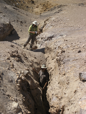
The field team spent much of 2008 and 2009 documenting surface deformation due to several thousand earthquakes in Iquique Gap. They surveyed about 11 kilometers (almost 7 miles) of scan lines across cracks in the area, measuring their width and orientation. They used a method called cosmogenic nuclide dating, which analyzes aluminum and beryllium isotope levels in quartz clasts, to determine the ages of the surface of the earth on both sides of the cracks. They then calculated the strain rate of the area, which allowed them to compare it to the modern GPS record.
“By using these cracks in this very dry area, we actually now have a statistically significant sample of thousands of earthquakes, because these cracks are the records of thousands of earthquakes,” Allmendinger said.
The Iquique Gap area hasn’t had a major earthquake since 1877; it will probably get one in the next several decades, Allmendinger said.
“This area has been particularly highly monitored in the last few years because people are expecting the earthquake,” he said.
The paper is titled “Permanent deformation caused by subduction earthquakes in northern Chile.” The research was supported by the National Science Foundation.
Media Contact
Get Cornell news delivered right to your inbox.
Subscribe