Design exhibit offers N.Y. town climate change defense
By Blaine Friedlander

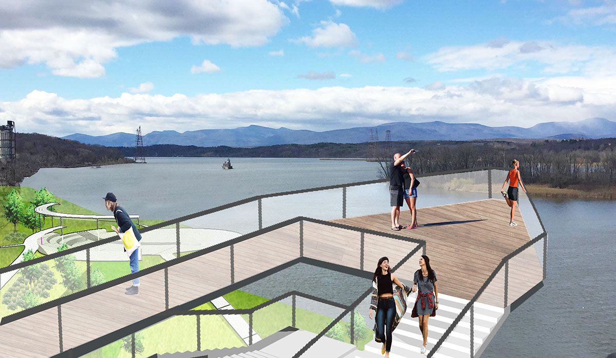
To keep riverfront communities intact in the face of rising waters due to climate change, landscape architecture master’s students at Cornell’s Climate-Adaptive Design (CAD) studio are sketching sturdy, flexible concepts for a city along New York’s Hudson River while factoring in the tide’s swell.
Concepts for the south bay riverfront in Hudson, New York, are collected in an exhibition, “Waterfront Futures: Designing Resilience for an Epoch of Rising Tides,” on display through July 4 at the Hudson Opera House. Hudson is about 38 miles south of Albany on the eastern side of the Hudson River.
The spring semester design process began with students examining the community’s watershed context, deciphering New York state projections for climate change, and designing solutions for floodable parks and flood-adapted buildings. Other problems to solve included ground-level train tracks, an industrial port and marshes that may migrate with rising sea levels. By conducting site visits and interviewing stakeholders, the students infused their designs with opportunities for Hudson.
“With rising sea levels and other climate change scenarios, I learned there are great opportunities to not only react to changes, but to design the environment in ways that are ecologically, economically and culturally resilient,” said Kyle Sitzman, graduate student in the field of landscape architecture. “By pre-emptively adapting, we can create places which respond to the effects of climate change, as opposed to repairing environments damaged by climate change.”
Landscape architecture graduate student Alice Sturm said it’s not a question of whether certain areas will flood, but determining their resilience in new conditions. In the designs, students determined infrastructure adaptations to maintain connection to the local economy, such as elevating a rail line and highway out of a future flood zone.
“We tried to harness them as opportunities to also create other social and ecological benefits,” she said. “Certain industries benefit from moving to higher ground where they won’t flood. The public benefits from open space that can function under a variety of water levels, and there are numerous ecological benefits to softening formerly reinforced shorelines, such as an increased fish breeding habitat.”
Fei Peng, graduate student in the field of landscape architecture, said that people will notice the water, and she suggests embracing it as a daily part of life. “As sea-level rise and flooding becomes the new normal, it is the time to think about living with the water. Floodable space can provide green space for recreation on normal days, and when flooding comes it can be closed to the public,” she said.
The CAD studio, taught by Josh Cerra, assistant professor of landscape architecture, is a research partnership among the Department of Landscape Architecture, Cornell’s Water Resources Institute and the New York State Department of Environmental Conservation’s Hudson River Estuary Program. In addition to Cerra, the planning and design team included Libby Zemaitis, Hudson River Estuary Program; Liz LoGiudice, Columbia-Greene Cornell Cooperative Extension; Jonathan Lerner, city of Hudson; and 17 graduate students. Cornell’s Department of Biological and Environmental Engineering provided guidance during the design process, while Scenic Hudson and Sustainable Shorelines also contributed resources to the project.
Media Contact
Get Cornell news delivered right to your inbox.
Subscribe