The town of Dryden, with support from Cornell, expects the Dryden Rail Trail to eventually provide a 14.4-mile corridor enabling car-free passage to and from Ithaca, advancing university and regional sustainability plans by reducing reliance on fossil fuels.
Trading coal cars for e-bikes, rail trail promotes sustainability
By James Dean
Just east of Ithaca in the Town of Dryden, a pair of wooden railroad trestles are remnants of an era when coal cars bound for Cornell’s heating plant rumbled regularly over a meandering Cascadilla Creek.
Newly restored and cleared of the overgrowth that claimed the former Lehigh Valley Railroad bed after a century of service ended in 1972, the bridges are now historic features in a short – but significant – new section of the Dryden Rail Trail.
The town, with support from Cornell, expects the multiuse trail to eventually provide a 14.4-mile corridor enabling car-free passage to and from Ithaca and the nearby communities of Varna, Etna, Freeville and Dryden, advancing university and regional sustainability plans by reducing reliance on fossil fuels.
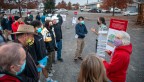
“Here the trail used to bring in coal to the university’s central heating plant, and now it will bring in people on e-bikes as we’re working to meet our climate-neutral goals,” said Todd Bittner, director of natural areas at Cornell Botanic Gardens and a member of Dryden’s Rail Trail Task Force. “Providing alternatives to get to campus or to Ithaca from other areas without a car is among our strategies.”
Cornellians have made a variety of important contributions to the initiative. Students developed an influential concept plan. Faculty, staff and alumni have served on the volunteer task force, which has won $2.5 million in grants, and in local government roles. And in addition to contributing $10,000, the university has agreed to easements on six parcels of land it owns, allowing public access to the trail.
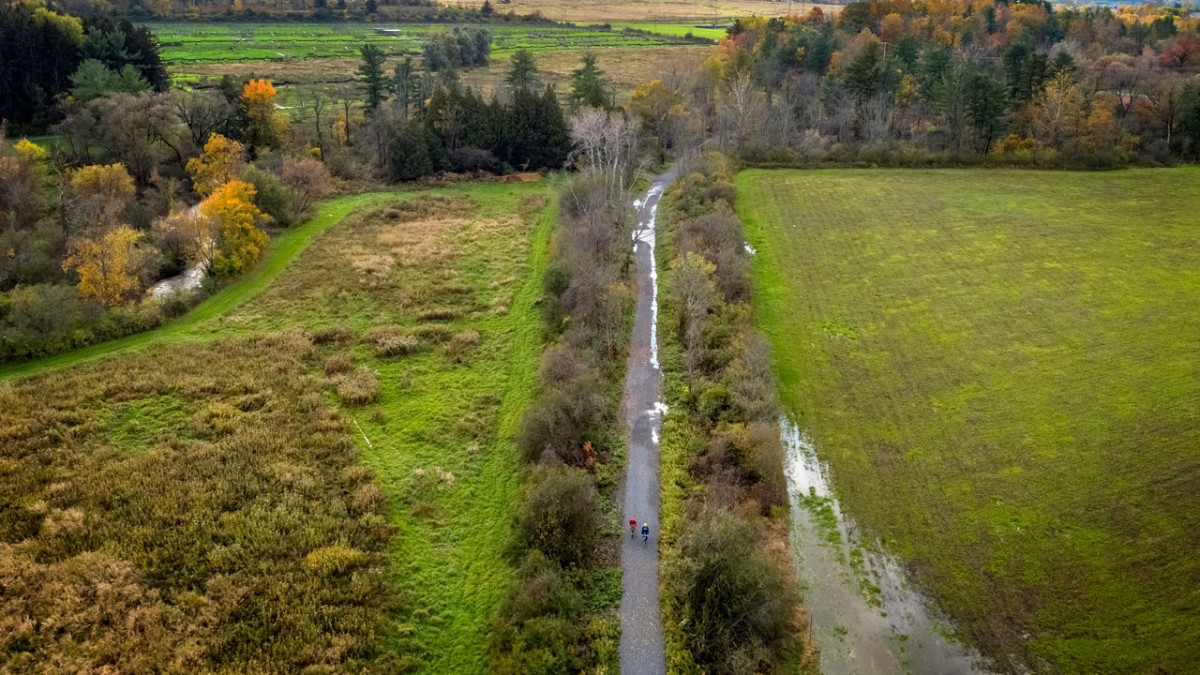
Aerial view of the Dryden Rail Trail.
“We’re really proud of this, and it does have a lot to do with the Cornell community,” said Dan Lamb, deputy supervisor for the Town of Dryden and a lecturer at the Cornell Institute for Public Affairs, part of the Cornell Jeb E. Brooks School of Public Policy. “We see this as a way to be a better partner in terms of some of the employee commute options and improving the quality of life for faculty, staff and students.”
In a July letter of support sent to Jason Leifer, the Dryden town supervisor, Vice President for University Relations Joel Malina said it was impressive to see how the rail trail plan aligned with key goals and strategies within the Tompkins County Comprehensive Plan, the Town of Dryden and Town of Ithaca comprehensive plans, the county’s 2020 Energy Strategy and the university’s Climate Action Plan.
“Thanks to Dryden’s leadership, our students, staff and faculty can look forward to new, shared connections over miles of hiking, pedestrian and bicycle trails and networks,” Malina wrote. “The completed rail trail will be a significant benefit to the broader community.”
Beyond transportation alternatives – the basis for several grants – advocates expect the trail to encourage smart growth, improve access to affordable housing and attract new businesses and tourism. The trail promises to connect three Cornell Botanic Gardens Natural Areas – Purvis Road Wetlands, Monkey Run and Upper Cascadilla – supporting “Nature Rx” benefits to physical and mental health that have become more widely appreciated during the pandemic.
Measuring 1,800 feet, the trail’s scenic new section running through the Reynolds Game Farm nearly completes a critical link to Cornell and Ithaca, but had long seemed unachievable.
For years, the New York State Department of Environmental Conservation (DEC) and sporting groups were hesitant to allow public access through the state’s last game farm, where pheasants are reared.
That was one of three major challenges facing planners of the proposed rail trail, whose tag line is “Connecting communities.” The town would also need easements from nearly 40 other landowners, and to build a bridge over Route 13 where it intersects near Route 366 (Dryden Road).
“For decades, among those of us who were thinking about a future public trail, most folks were saying this could never happen,” said Bob Beck ’64, who chairs the task force. “Well, some of us never gave up.”
The project received a boost in 2015 when students in the College of Architecture, Art and Planning’s Design Connect program agreed to develop a concept plan. The team conducted research, gathered feedback, hosted community charettes and wrote a plan that detailed opportunities, challenges and potential costs to build the trail.
“That was a catalyst for this project to go forward with a lot of community support,” Bittner said. “People could take something that was abstract before and envision what it might look like, and it really jumpstarted things and provided a good foundation.”
The town established the task force the following year.
Since then, the town has secured commitments for easements on 42 of 48 pieces of land covering about eight miles of trail, with the remainder in negotiation. And a bridge over Route 13 – deemed the safest, most cost-effective and commuter-friendly way to cross the busy highway – is in design. More than $2.35 million in state and federal grants will substantially cover its cost.
An agreement to access the exclusive game farm site came through earlier this year, culminating lengthy and complex negotiations. Lamb – who rekindled discussions in 2017 after the DEC’s then-deputy commissioner visited his intergovernmental relations class – called the renewable 20-year agreement creative and unprecedented.
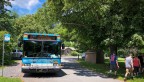
Over the summer, town highway crews cleared away brush from the nearly impenetrable stretch of rail bed and refurbished the two roughly 150-year-old trestles, adding wooden guardrails. They installed a 10-foot-wide surface of fine, packed “stone dust” gravel compliant with the Americans with Disabilities Act, as intended throughout the rail bed corridor, on which motorized vehicles are prohibited but e-bikes allowed.
The Game Farm Section starts at Stevenson Road, where a three-mile trail already runs in the opposite direction toward Route 13, past a Cornell composting facility, the Cascadilla Community Solar Farm and eastward over the F.H. Fox Bridge. For now, the new section terminates at Game Farm Road directly across from the East Ithaca Recreation Way, which runs to the edge of the university near Pine Tree Road, not far from where the East Ithaca station once received train passengers and coal deliveries.
The Town of Dryden is seeking approval for a safe crossing at Game Farm Road to complete the long-sought link to the rec trail. Walkers and cyclists currently must detour over roads with limited shoulders and fast-moving traffic to continue along the trails – a disincentive to trail users, Lamb said.
“Particularly for commuters, you want to go the shortest distance between two points, and one of the nice things about rail beds is they’re generally pretty straight,” Lamb said. “One of the project’s goals is to reduce traffic and reliance on automobiles to get to Cornell, and this trail really delivers people right to the campus.”
Get Cornell news delivered right to your inbox.
Subscribe